Innovations
What are NEMO-Tools novelties?
NEMO-Tools is ambitious in the diversity of hard (Remotely Operated Vehicle (ROVs), drones, Unmanned Ground Vehicle (UGV)) and soft (eDNA, AI) technologies that are tested with spatial replication and in producing innovative data-driven measures of biodiversity and ecosystem change at different spatial and temporal scales. These novelties are feasible due to the unprecedented availability of biodiversity data and computational methods and have been inspired by our experience in such analyses at local, national, regional and global scales.
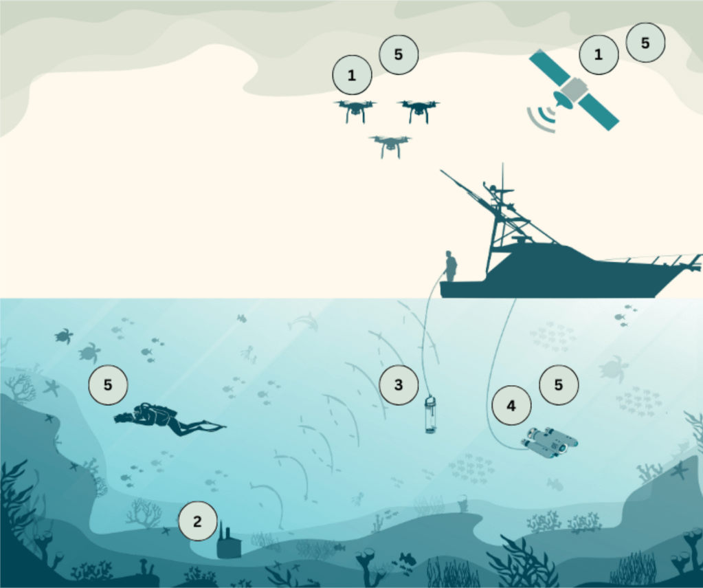


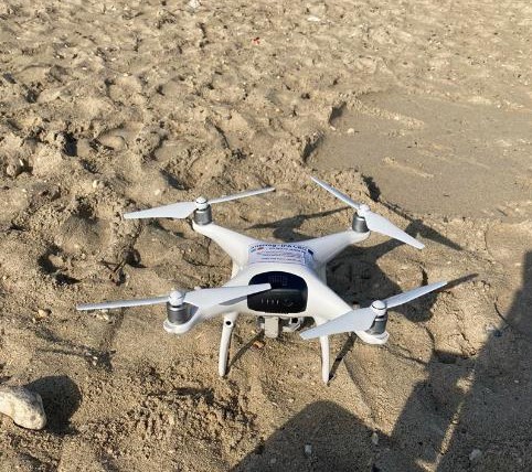
1. Remote Sensing
- Characterize habitats, assess biodiversity patterns, and map functional groups and key species using multi-scale optical and thermal observation techniques.
- Utilize the latest space (Planet SuperDove satellites) and drone (UAVs) technologies for high-resolution, scalable data collection.
- Enable spectral identification of macroalgae life cycles and detect vegetation changes with novel processing frameworks.
- Detect seasonal and spatial distribution of marine hotspots and risk areas for marine megafauna.
2. Acoustics
- Develop a novel, inexpensive (~€50) hydrophone to detect marine mammal presence, movement patterns, and assess underwater noise levels.
- Manufacture and distribute one hundred hydrophones.
- Deploy through a citizen-science initiative for large-scale underwater sound data collection.
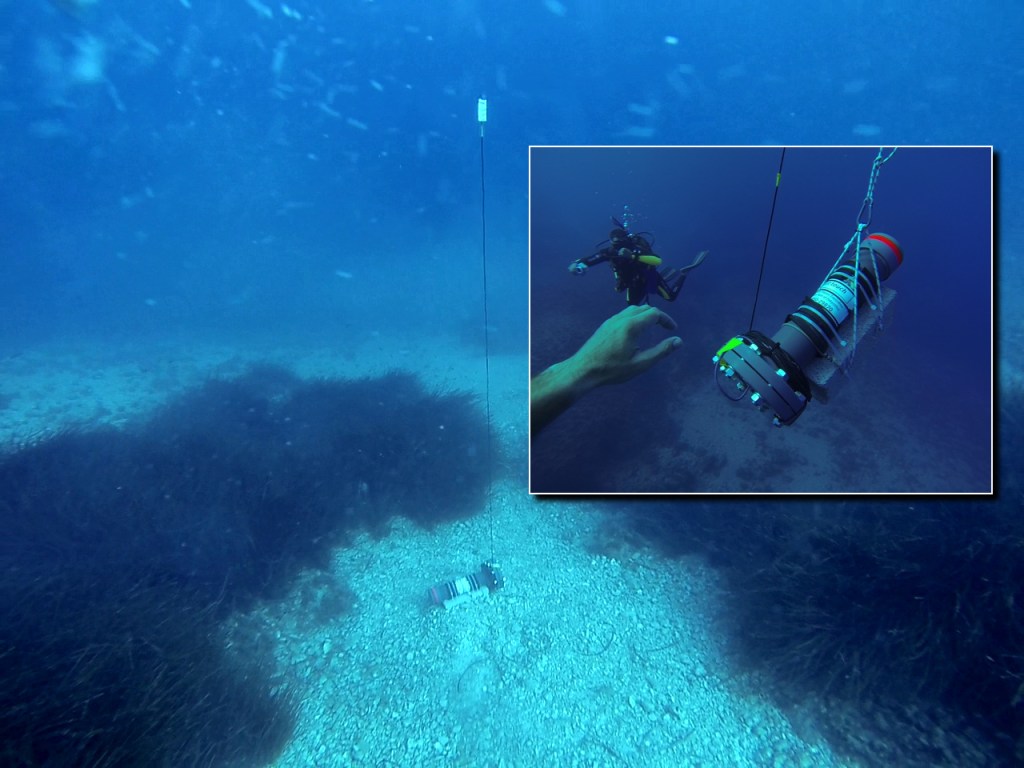
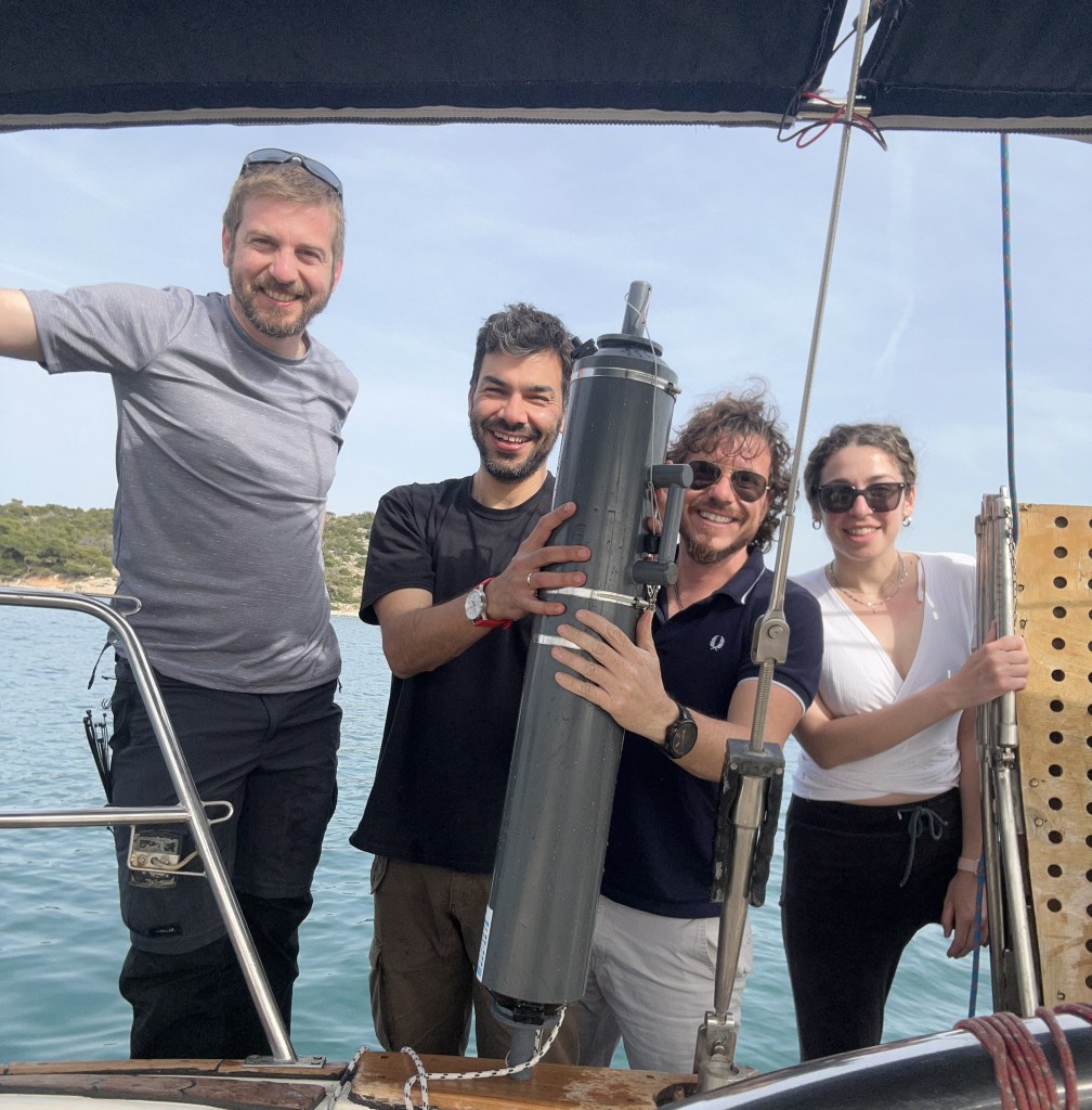
3. eDNA
- Develop innovative, cost-effective, and non-invasive eDNA sampling strategies for key taxa.
- Establish optimal protocols to assess biodiversity, including threatened and invasive species.
- Provide evidence and models for the statistical analysis of eDNA samples.
- Create protocols for volunteer divers to sample eDNA.
- Conduct ground-truth eDNA surveys with in-situ validations, comparing eDNA results to visual-survey and fisheries data.
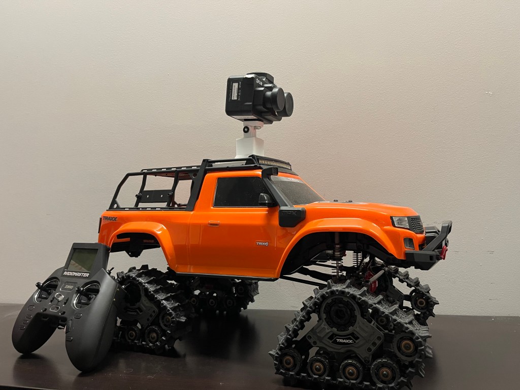
4. Autonomous & Remotely Operated Vehicles
Upgrade mobile platforms with scientific sensors to enable affordable, non-invasive environmental observations:
- ROV (Remotely Operated Vehicle) adapted for systematic photographic sampling and distance sampling surveys to estimate demersal fish and invertebrate population density and abundance.
- Integrated UGV (Unmanned Ground Vehicle) with fixed thermal cameras to extend coastal data coverage from a few centimeters to a few kilometers.
5. Artificial Intelligence
- Develop AI algorithms for automatic and accurate detection of rocky reef species in photos and videos to enhance data quality and abundance.
- Extract oceanographic, habitat, and anthropogenic features from satellite images and seabed data to improve predictive models.
- Train and test AI tools for accurate and automated classification and identification of Mediterranean macroalgae and fish species.
- Utilize information from recreational divers, fishers, and tourists to improve understanding and knowledge of marine biodiversity.