Mapping subtidal seascapes and seabed has a long history.
Using satellites, Jacques Cousteau and NASA create bathymetry maps for Bahamas using Landsat observations.
Seagrass and satellites have strong bond since early 1980s.
Macroalgae, floating and emerged also – emphasis on Kelp forests, lots of publications and operation monitoring tools.
But for the humble submerged Cystoseira s.l., nada!
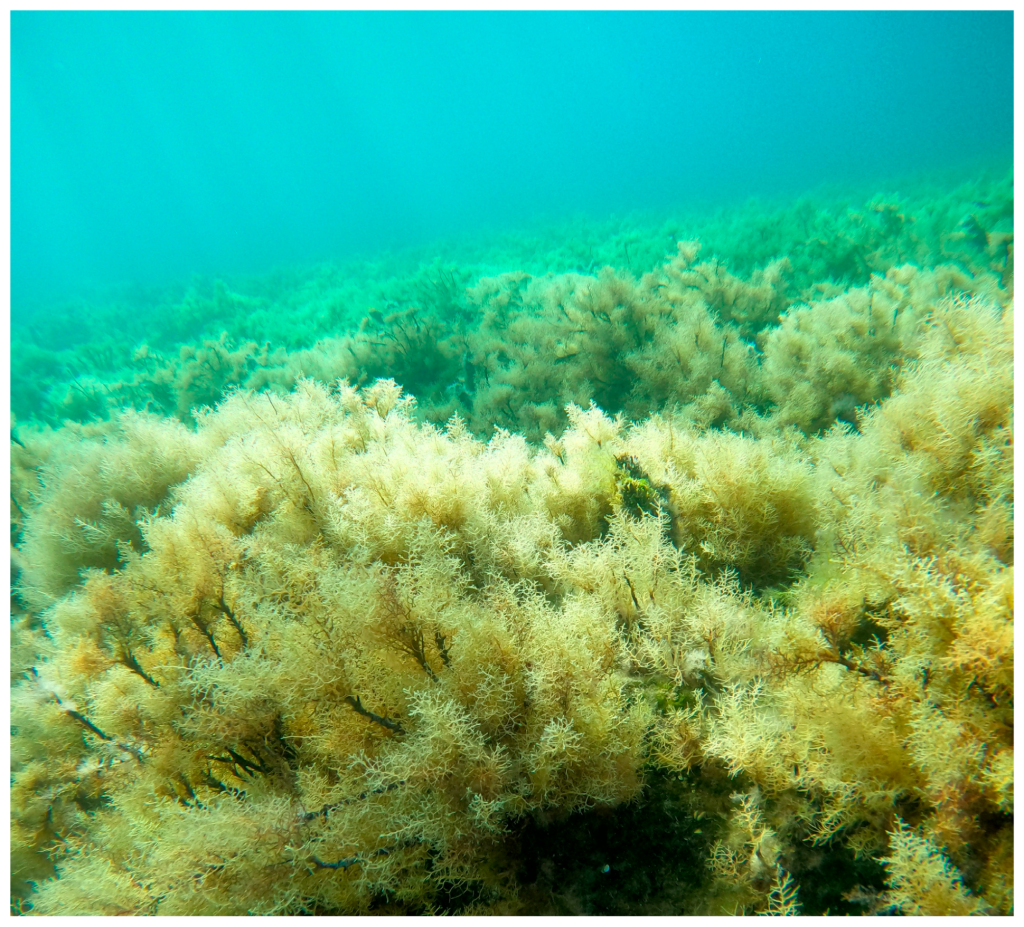
We worked to see how far we can go with the current technologies of satellites.
High resolution (3m pixel size here and higher if available at the peak time of biomass) with GOOD and ACCURATE field data and clear dominance of Cystoseira s.l. (>80% per unit area) are the minimum requirements to make it happen.
So, yes, but acknowledging the limitations of the current satellites (spectrally) and the specifications (what is the bare minimum) to make it happen.
Here is the publication https://www.mdpi.com/2072-4292/17/14/2398
A work funded by NEMO-tools and C-BLUES projects.
Happy to discuss further and support your needs.
Don’t hesitate to contact the NEMO-tools team!
